 Transit Maps Free v.1.1.0.0
Advertisement
Description
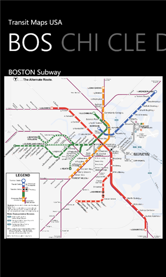
The only Transit Maps app of its kind. You can select the city you want to see the transit maps for and zoom in to view the map in detail on the full screen. You can easily zoom-in, pan, and zoom-out using one hand only. You can now plan your trip from anywhere, any time - no Internet/data connection required. Imagine having the ease of mind that you will always know what line to catch to go where you want to go.
Give it a try. Your...
Read more
- Rate:
- Release Date:08/26/2012
- License:Freeware
- Category:Recreation
- Developer:Paras Wadehra
- Downloads:54
- Size:3 Mb
- Price: Free
To free download a trial version of Transit Maps Free, click here
To visit developer homepage of Transit Maps Free, click here
Advertisement
Screen Shot
Click on a thumbnail for the larger image.
System Requirements
Transit Maps Free requires Windows Phone 7 or higher | owner identity, photo, music, and video libraries, data services, HD720P (720x1280), WVGA (480x800), WXGA (768x1280) | English
Transit Maps Free v.1.1.0.0 Copyright
Shareware Junction periodically updates pricing and software information of Transit Maps Free v.1.1.0.0 full version from the publisher using pad file and submit from users. Software piracy is theft, Using crack, password, serial numbers, registration codes, key generators, cd key, hacks is illegal and prevent future development of Transit Maps Free v.1.1.0.0 Edition. Download links are directly from our publisher sites. Links Transit Maps Free v.1.1.0.0 from Bittorrent, mediafire.com, uploadfiles.com, hotfiles.com rapidshare.com, megaupload.com, netload.in, storage.to, depositfiles.com and other files hosting are not allowed. The download file is obtained directly from the publisher, not from any Peer to Peer file sharing applications such as Shareaza, Limewire, Kazaa, Imesh, eDonkey, eMule, Ares, BearShare, Overnet, Morpheus, BitTorrent Azureus and WinMX.
Review This Software
More Transit Maps Free Software
Advertisement


Transit Maps USA v.1.2.0.0
NEW TRIAL FUNCTIONALITY - TRY BEFORE YOU BUY! The only Transit Maps app of its kind. You can select the city you want to see the transit maps for and zoom in to view the map in detail on the full screen. You can easily zoom-in, pan, and zoom-out

CTA Subway Transit v.1.1.0.0
Chicago CTA Transit provides free arrival predictions on the Chicago subway system.

KL Transit Map by SC v.1.0.0.0
Kuala Lumpur Transit Maps. A must have apps if you visit to Kuala Lumpur, Malaysia. You can easily zoom-in, pan, and zoom-out.

Transit v.1.1.0.0
TRANSIT has been developed with the everyday public transportation commuter in mind. v1.1: • Minor stability and bug fixes • Revamped error logging and reporting This application offers Washington, DC Metro area transportation information and
Tracking The Eye.NET v.8.5.739
Tracking The Eye is a full hurricane tracking application that can connect to the Internet and get storm coordinates with the press of a button. Hurricane Hunting Has never been more fun, Tracking The Eye is a state of the art .
AdRem MyNet Toolset v.1.0.0.116
This tool detects all nodes in your local network and displays them on the graphical network map. It allows the user to personalize popup menu for each node for easy access to common network tools.
Free Satellite Maps v.1
Free Satellite Maps is a free tool from Google which offers a satellite mapping service worldwide.These are accompanied by a street service, a route planner and information about business in almost all countries.

Mango Transit (free) v.5.1.0.0
Public transit directions, Mango style. Powered by Bing and Nokia. Mango Transit is the most advanced public transit app for Windows Phone. It is designed to be an extension of the native Map app. Submit your ideas to have them included in the
FusionCharts Free
FusionCharts Free is a flash charting component that can be used to render data-driven & animated charts for your web applications and presentations. It is a cross-browser and cross-platform solution that can be used with ASP.NET, ASP, PHP, JSP,
Risk Management Tools FREE Edition v.1.6
FREE fully-featured comprehensive Risk Management analysis software solution tools. This objective-centered risk management software focuses on qualitative risk and control assessments; it is aligned with ISO31000. All registers are integrated.

GPS to SMS Free v.1.4.0.0
GPS to SMS Free is an app that makes it possible to share your current location by sending it via SMS or e-mail. The message contains the GPS position data and a link to Bing Maps. It also works (limited) without internet connection, so its a great
Other products of this developer Paras Wadehra

NPR RSS Reader v.1.1.0.0
NPR News - Now you can have your news on the go....y, just select "open in ie" from the menu at the

SketchPad v.1.2.0.0
***** SHOWCASED IN APP HIGHLIGHTS BY NOKIA AT #1...on your device using a vast color palette and to

Transit Maps USA v.1.2.0.0
NEW TRIAL FUNCTIONALITY - TRY BEFORE YOU BUY! T...creen. You can easily zoom-in, pan, and zoom-out